
Make a donation
Gear up for your next adventure:
As an Amazon Associate, this site earns from qualifying purchases at no extra cost to you.
Citrus Park topographic map
Click on the map to display elevation.
Make a donation
Gear up for your next adventure:
As an Amazon Associate, this site earns from qualifying purchases at no extra cost to you.
About this map
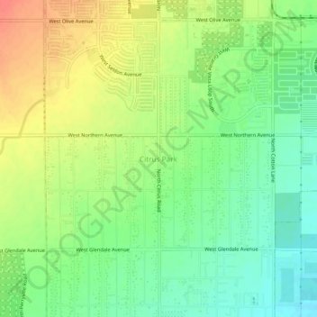
Name: Citrus Park topographic map, elevation, terrain.
Average elevation: 360 m
Minimum elevation: 336 m
Maximum elevation: 388 m
Make a donation
Gear up for your next adventure:
As an Amazon Associate, this site earns from qualifying purchases at no extra cost to you.
Other topographic maps
Click on a map to view its topography, its elevation and its terrain.
Fountain Hills
United States > Arizona > Maricopa County
Fountain Hills is in eastern Maricopa County, on the eastern edge of the Phoenix urbanized area. It is 31 miles (50 km) northeast of downtown Phoenix and sits on the east side of the south end of the McDowell Mountains. According to the U.S. Census Bureau, the town has a total area of 20.4 square miles (53…
Average elevation: 503 m
Make a donation
Gear up for your next adventure:
As an Amazon Associate, this site earns from qualifying purchases at no extra cost to you.
Gila Bend
United States > Arizona > Maricopa County
According to the United States Census Bureau, the town has a total area of 64.4 square miles (167 km2), all of it land.[2] Situated at 735 feet (224 m) above sea level, Gila Bend has the lowest elevation of any city in Maricopa County and in Greater Phoenix overall.[19]
Average elevation: 257 m