
猪苗代町 topographic map
Interactive map
Click on the map to display elevation.
About this map
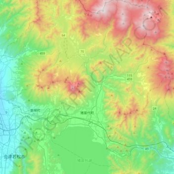
Name: 猪苗代町 topographic map, elevation, terrain.
Location: 猪苗代町, 耶麻郡, 福岛县, 日本 (37.44863 140.01434 37.75651 140.28525)
Average elevation: 797 m
Minimum elevation: 181 m
Maximum elevation: 2,026 m
Other topographic maps
Click on a map to view its topography, its elevation and its terrain.