Geolocate

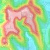
Waterfall topographic map

Click on the map to display elevation.

About this map

Name: Waterfall topographic map, elevation, terrain.

Location: Waterfall, Huntsville, Madison County, Alabama, 35741, United States (34.71461 -86.46134 34.71471 -86.46124)

Average elevation: 310 m

Minimum elevation: 185 m

Maximum elevation: 482 m

Other topographic maps

Click on a map to view its topography, its elevation and its terrain.

Gear up for your next adventure:

📖Outdoor Guide Books - Expert guides for Irish nature
🧯Campfire Safety Gear - Gear to safely manage fires
📚Irish Walking Guides - The best mapped trails in Wicklow, Kerry, and Connemara
🧴Long-Lasting Sunscreen - Protect against UV rays during long days on the ridges
🧴Anti-Chafe Sticks - Prevent friction during long distance walking

As an Amazon Associate, this site earns from qualifying purchases at no extra cost to you.