Geolocate

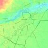
Hunts Crossroads topographic map

Click on the map to display elevation.

About this map

Name: Hunts Crossroads topographic map, elevation, terrain.

Location: Hunts Crossroads, Darlington County, South Carolina, United States (34.41210 -80.06729 34.45210 -80.02729)

Average elevation: 73 m

Minimum elevation: 51 m

Maximum elevation: 111 m

Other topographic maps

Click on a map to view its topography, its elevation and its terrain.
Gear up for your next adventure:

🎽Thermal Base Layers - Essential moisture management for cold weather
💺Camping Hammocks - Relax afloat camp setup
🛠️Tent Repair Kits - Fix tents on the trail
🥾Mountaineering Boots - Heavy‑duty boots for rugged peaks
🔦High-Lumen Headlamps - Hands-free lighting for early starts or late finishes

As an Amazon Associate, this site earns from qualifying purchases at no extra cost to you.