Geolocate

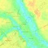
Darlington topographic map

Click on the map to display elevation.

About this map

Name: Darlington topographic map, elevation, terrain.

Location: Darlington, Darlington County, South Carolina, 29532, United States (34.28060 -79.90080 34.32140 -79.83376)

Average elevation: 45 m

Minimum elevation: 26 m

Maximum elevation: 59 m

Other topographic maps

Click on a map to view its topography, its elevation and its terrain.
Gear up for your next adventure:

🌦️Weatherproof Outdoor Gear - Protection from unpredictable weather
🥾Lightweight Hiking Shoes - Light, breathable shoes for trail walking
🦯Lightweight Trekking Poles - Reduce knee strain on steep Wicklow or Kerry slopes
🎁Outdoor Gift Ideas - Great gifts for adventurers
🪶Ultralight Tents - Lightweight shelters for hikers

As an Amazon Associate, this site earns from qualifying purchases at no extra cost to you.