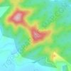
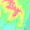
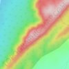
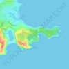
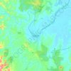
Comboyne topographic map
Click on the map to display elevation.
Comboyne
The annual average rainfall at Comboyne is a high 1818 mm. The climate is sub tropical, though at an elevation of 588 metres, it is cooler than at the coast nearby. Soils are derived from basalt, which provide a deep red loam. Below the basalt are less fertile sedimentary rocks. The Comboyne Shield Volcano erupted some 11 to 13 million years ago. The Comboyne plateau is a scarp-bounded paleoplain located between the central north coast of New South Wales and the Great Dividing Range. Miocene basalts overlie much of the plateau, creating relatively fertile red/brown soils. In the southern third of the plateau are underlying Triassic sediments of the Lorne basin. The plateau has a wet, sub tropical climate, though subject to frost and occasional snow.
About this map

Name: Comboyne topographic map, elevation, terrain.
Location: Comboyne, New South Wales, Australia (-31.66553 152.41487 -31.52778 152.52804)
Average elevation: 435 m
Minimum elevation: 78 m
Maximum elevation: 804 m
Other topographic maps
Click on a map to view its topography, its elevation and its terrain.


Sydney
Phillip had been given no instructions for urban development, but in July 1788 submitted a plan for the new town at Sydney Cove. It included a wide central avenue, a permanent Government House, law courts, hospital and other public buildings, but no provision for warehouses, shops, or other commercial…
Average elevation: 32 m


Gaanha-bula–Mount Canobolas
With an elevation of 1,390 metres (4,560 ft) above sea level, Mount Canobolas, an extinct volcano, is the highest mountain in the region. Situated 13 kilometres (8.1 mi) southwest of the city of Orange, it is about 250 kilometres (155 mi) west of Sydney.
Average elevation: 1,186 m

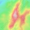
Mount Kosciuszko
Mount Kosciuszko is the highest summit in mainland Australia. Until 1977 it was possible to drive from Charlotte Pass to within a few metres of the summit, but in 1977 the road was closed to public motor vehicle access due to environmental concerns. The road is open from Charlotte Pass for walkers and cyclists…
Average elevation: 2,035 m







Woronora Dam
The wall of Woronora Dam is an engineering work imbued with a sense of high aesthetic value expressed through the long curved high wall set with the wide valley of the Woronora River. Upstream of the dam wall this setting is characterised by the broad expanse of the pool of water bordered by the crests of the…
Average elevation: 198 m













Australian Alps
The Australian Alps are a mountain range in southeast Australia. It comprises an interim Australian bioregion, and is the highest mountain range in Australia. The range straddles the borders of eastern Victoria, southeastern New South Wales, and the Australian Capital Territory. It contains Australia's only…
Average elevation: 2,037 m