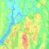
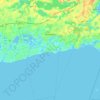
Cape Cod Bay topographic map
Click on the map to display elevation.
Cape Cod Bay
The Cape's lifeline is groundwater. Rain and melting snow swiftly sink into the sandy soils, where it pools to form a massive subterranean groundwater reservoir beneath the majority of the Cape. Groundwater continues to flow into and out of ponds, feeding streams, and flowing towards the coast, finding sea level when it enters our estuaries and embayments, as water seeks the lowest elevation. Drinking water comes entirely from groundwater. This sole-source aquifer, which is protected by local, regional, state, and federal restrictions, provides all of the Cape's drinking water.
About this map

Name: Cape Cod Bay topographic map, elevation, terrain.
Location: Cape Cod Bay, Massachusetts, United States (42.03339 -70.41619 42.03349 -70.41609)
Average elevation: 0 m
Minimum elevation: 0 m
Maximum elevation: 0 m
Other topographic maps
Click on a map to view its topography, its elevation and its terrain.

Bellingham
United States > Massachusetts > Bellingham
According to the United States Census Bureau, the town has a total area of 19.0 square miles (49.2 km2), of which 18.5 square miles (47.9 km2) is land and 0.5 square mile (1.3 km2) (2.58%) is water. The town's mean elevation is 293 feet (89 m) above sea level.
Average elevation: 84 m

Chicopee
United States > Massachusetts > Hampden County
Willimansett, and portions of the Center and Falls are on low land, with Aldenville, Fairview, Westover, and the Burnett Road neighborhoods on an elevated plateau. At 288 feet, the highest elevation in the city is on Old Lyman Road, in the Fairview section.
Average elevation: 67 m

Cape Cod
United States > Massachusetts > Barnstable County
Cape Cod extends 65 miles (105 km) into the Atlantic Ocean, with a breadth of between 1–20 miles (1.6–32.2 km), and covers more than 400 miles (640 km) of shoreline. Its elevation ranges from 306 feet (93 m) at its highest point, at the top of Pine Hill, in the Bourne portion of Joint Base Cape Cod, down…
Average elevation: 2 m


Russell
United States > Massachusetts > Hampden County
The town has two very different sections: South Quarter is mainly uplands at elevations from 1,000 to 1,400 feet (300 to 430 m) along the rim of a plateau west of the Connecticut River Valley, while the rest of the town is a deep valley along the swift Westfield River.
Average elevation: 256 m


Danvers
United States > Massachusetts > Essex County > Danvers
Though being at sea level in the Danversport area, the town has numerous hills reaching around 130 to 180 feet in elevation, including Dales Hill (located at St. John's Preparatory School), Ferncroft Hill, Folly Hill, Hathorne Hill, Lindall Hill, Nichols Hill, Putnam Hill, Rocky Hill and Whipple Hill (part of…
Average elevation: 22 m


Lake Chaubunagungamaug
United States > Massachusetts > Worcester County > Webster
Average elevation: 160 m

Leverett
United States > Massachusetts > Franklin County
According to the United States Census Bureau, the town has a total area of 23.0 square miles (60 km2), of which 22.9 square miles (59 km2) are land and 0.1-square-mile (0.26 km2) (0.61%) is water. Leverett is located on the edge of the Pioneer Valley and the hills of northwestern Massachusetts, just east of…
Average elevation: 220 m


Williams Conservation Land
United States > Massachusetts > Essex County > Wenham
Average elevation: 23 m

New Bedford
United States > Massachusetts > Bristol County
New Bedford is located at 41°39′06″N 70°56′01″W / 41.651803°N 70.933705°W / 41.651803; -70.933705 (41.651803, −70.933705). According to the United States Census Bureau, the city has a total area of 24.1 square miles (62.5 km2). Of the total area, 20.0 square miles (51.8 km2) is land, and…
Average elevation: 21 m


Worcester
United States > Massachusetts > Worcester County
Worcester is known for being particularly snowy in the cold months, sometimes even experiencing intense autumn blizzards. The city averages 48.07 inches (1,220 mm) of precipitation a year, as well as an average of 64 inches (160 cm) of snowfall a season, receiving far more snow than coastal locations less than…
Average elevation: 186 m


Gardner
United States > Massachusetts > Worcester County
According to the United States Census Bureau, Gardner has a total area of 23.0 square miles (60 km2), of which 22.2 square miles (57 km2) is land and 0.8 square miles (2.1 km2), or 3.52%, is water. The city is situated on Crystal Lake. Its highest point is the summit of Reservoir Hill, close to the city…
Average elevation: 326 m


Hadley
United States > Massachusetts > Hampshire County
According to the United States Census Bureau, the town has a total area of 24.6 square miles (63.7 km2), of which 23.1 square miles (59.8 km2) is land and 1.5 square miles (3.9 km2), or 6.18%, is water. The land boundaries of Hadley are Sunderland to the north, Amherst to the east, and South Hadley to the…
Average elevation: 74 m

Aggasiz Rock
United States > Massachusetts > Essex County > Essex > South Essex
Average elevation: 30 m

CR #10
United States > Massachusetts > Barnstable County > Falmouth > Saconesset Hills
Average elevation: 14 m


Rockaway Conservation Area
United States > Massachusetts > Essex County > Peabody
Average elevation: 36 m