
Simrishamns kommun topographic map
Interactive map
Click on the map to display elevation.
About this map
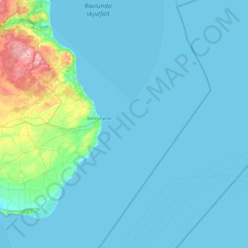
Name: Simrishamns kommun topographic map, elevation, terrain.
Location: Simrishamns kommun, Skåne County, Region Götaland, Sweden (55.32334 14.06082 55.76654 14.72042)
Average elevation: 16 m
Minimum elevation: -1 m
Maximum elevation: 184 m
Other topographic maps
Click on a map to view its topography, its elevation and its terrain.