

Imst topographic map
Click on the map to display elevation.
Imst
Imst (German: [ɪmst] ; Southern Bavarian: Imscht) is a town in the Austrian federal state of Tyrol. It lies on the River Inn in western Tyrol, some 50 kilometres (31 miles) west of Innsbruck and at an altitude of 828 metres (2,717 feet) above sea level. With a current population (2018) of 10,504, Imst is the administrative centre of Imst District.
About this map
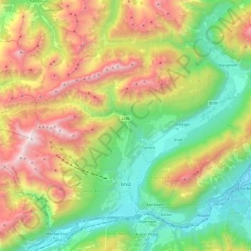
Name: Imst topographic map, elevation, terrain.
Location: Imst, Bezirk Imst, Tyrol, Austria (47.21095 10.53837 47.34094 10.77582)
Average elevation: 1,485 m
Minimum elevation: 666 m
Maximum elevation: 2,744 m
Other topographic maps
Click on a map to view its topography, its elevation and its terrain.









Oberlängenfeld
Austria > Tyrol > Bezirk Imst > Gemeinde Längenfeld > Längenfeld
Average elevation: 1,584 m


Unterlängenfeld
Austria > Tyrol > Bezirk Imst > Gemeinde Längenfeld > Längenfeld
Average elevation: 1,590 m