
木渎镇 topographic map
Interactive map
Click on the map to display elevation.
About this map
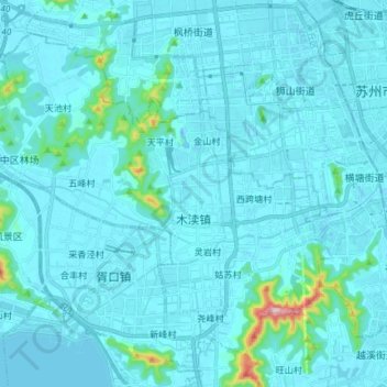
Name: 木渎镇 topographic map, elevation, terrain.
Location: 木渎镇, 吴中区, 苏州市, 江苏省, 215101, 中国 (31.21536 120.41676 31.32013 120.56447)
Average elevation: 18 m
Minimum elevation: -9 m
Maximum elevation: 279 m
Other topographic maps
Click on a map to view its topography, its elevation and its terrain.