
Make a donation
Gear up for your next adventure:
As an Amazon Associate, this site earns from qualifying purchases at no extra cost to you.
Varena topographic map
Click on the map to display elevation.
Make a donation
Gear up for your next adventure:
As an Amazon Associate, this site earns from qualifying purchases at no extra cost to you.
About this map
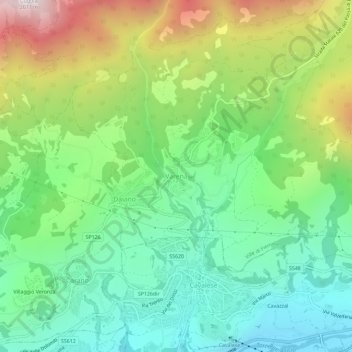
Name: Varena topographic map, elevation, terrain.
Average elevation: 1,257 m
Minimum elevation: 847 m
Maximum elevation: 2,042 m
Make a donation
Gear up for your next adventure:
As an Amazon Associate, this site earns from qualifying purchases at no extra cost to you.
Other topographic maps
Click on a map to view its topography, its elevation and its terrain.
Parco naturale dell'Adamello-Brenta
Italy > Trentino-Alto Adige/Südtirol > Provincia di Trento > Carisolo
Average elevation: 1,938 m
Castel Beseno
Italy > Trentino-Alto Adige/Südtirol > Provincia di Trento > Besenello > Sottocastello
Average elevation: 389 m
Make a donation
Gear up for your next adventure:
As an Amazon Associate, this site earns from qualifying purchases at no extra cost to you.
Make a donation
Gear up for your next adventure:
As an Amazon Associate, this site earns from qualifying purchases at no extra cost to you.
Val di Non
Italy > Trentino-Alto Adige/Südtirol > Provincia di Trento > Ville d'Anaunia
Average elevation: 989 m
Make a donation
Gear up for your next adventure:
As an Amazon Associate, this site earns from qualifying purchases at no extra cost to you.
Maroc
Italy > Trentino-Alto Adige/Südtirol > Provincia di Trento > Folgaria > Scandelli
Average elevation: 913 m
Andalo
Italy > Trentino-Alto Adige/Südtirol > Provincia di Trento > Andalo
The town lies on the Paganella plateau, between the mountains Piz Galin, elevation 2,442 metres (8,012 ft), and Paganella, 2,125 metres (6,972 ft), and its territory is part of the Adamello-Brenta natural park.
Average elevation: 1,369 m
San Martino di Castrozza
Italy > Trentino-Alto Adige/Südtirol > Provincia di Trento
Average elevation: 2,005 m
Make a donation
Gear up for your next adventure:
As an Amazon Associate, this site earns from qualifying purchases at no extra cost to you.