
Bathhurst Head (S 2) topographic map
Interactive map
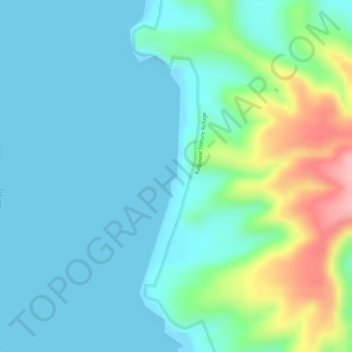
Click on the map to display elevation.
About this map
Name: Bathhurst Head (S 2) topographic map, elevation, terrain.
Average elevation: 34 m
Minimum elevation: 0 m
Maximum elevation: 143 m
Other topographic maps
Click on a map to view its topography, its elevation and its terrain.
Picnic Point
Australia > Queensland > Toowoomba
The first addition to the Picnic Point Reserve was made when the Municipal Council purchased two freehold allotments fronting both Heller and Rowbotham Streets in 1902. By 1906 the council had commenced tree-planting at Picnic Point under the supervision of Curator Harding of the Botanical gardens. A further…
Average elevation: 575 m
Sunshine Coast Regional
The Sunshine Coast Regional area in Queensland, Australia, features a diverse topography that ranges from coastal plains to rugged hinterlands. Along the coastline, the terrain is predominantly flat, with average elevations around 20 meters (66 feet) above sea level. Inland, the landscape transitions to…
Average elevation: 56 m
Warwick
Warwick experiences an altitude-influenced humid subtropical climate (Köppen: Cfa), with very warm summers and mild, relatively dry winters with cold nights. Annual precipitation averages 662.4 millimetres (26.08 in), with a summer maximum. The town is slightly cooler and less humid than the proximate…
Average elevation: 474 m