Geolocate

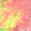
Sivry-Rance topographic map

Click on the map to display elevation.

About this map

Name: Sivry-Rance topographic map, elevation, terrain.

Location: Sivry-Rance, Thuin, Hainaut, Wallonia, 6470, Belgium (50.12045 4.12712 50.21560 4.30429)

Average elevation: 225 m

Minimum elevation: 163 m

Maximum elevation: 272 m

Other topographic maps

Click on a map to view its topography, its elevation and its terrain.
Chimay

Belgium > Hainaut > Thuin

Average elevation: 252 m

Nalinnes

Belgium > Hainaut > Thuin

Average elevation: 216 m

Forge-Philippe

Belgium > Hainaut > Thuin > Forge-Philippe

Average elevation: 296 m

Boussu-lez-Walcourt

Belgium > Hainaut > Thuin

Average elevation: 231 m

Gear up for your next adventure:

🎒Hiking Backpacks - Durable backpacks for day hikes and multi‑day treks
🔪Multi‑Tools & Knives - Versatile tools for outdoor tasks
🧿Outdoor Gadgets - Innovative tools for outdoor enthusiasts
🧴Hiking Sunscreen - Sun protection for long exposure
🎒Surveyor High-Vis Vests - Multi-pocket safety vests for field professionals

As an Amazon Associate, this site earns from qualifying purchases at no extra cost to you.