Geolocate

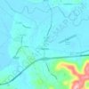
Slade topographic map

Click on the map to display elevation.

About this map

Name: Slade topographic map, elevation, terrain.

Location: Slade, Powell County, Kentucky, 40376, United States (37.77508 -83.72408 37.81508 -83.68408)

Average elevation: 311 m

Minimum elevation: 210 m

Maximum elevation: 409 m

Other topographic maps

Click on a map to view its topography, its elevation and its terrain.

Natural Bridge

United States > Kentucky > Powell County

Average elevation: 314 m

Stanton

United States > Kentucky > Powell County

Average elevation: 215 m

Stanton

United States > Kentucky > Powell County

Average elevation: 215 m

Clay City

United States > Kentucky > Powell County

Average elevation: 202 m

Gear up for your next adventure:

🏃‍♀️Running Hydration Belts - Hydration on the go for runners
🧴Long-Lasting Sunscreen - Protect against UV rays during long days on the ridges
🌲Survival Gear - Equipment for outdoor survival situations
🧊Hydration Reservoirs - Easy drinking on the move with 2L or 3L bladders
🔋Lithium Batteries - Best performance for digital devices in cold weather

As an Amazon Associate, this site earns from qualifying purchases at no extra cost to you.