Geolocate

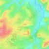
Lye topographic map

Click on the map to display elevation.

About this map

Name: Lye topographic map, elevation, terrain.

Location: Lye, Châteauroux, Indre, Centre-Val de Loire, Metropolitan France, 36600, France (47.19975 1.40874 47.23977 1.52801)

Average elevation: 111 m

Minimum elevation: 69 m

Maximum elevation: 144 m

Other topographic maps

Click on a map to view its topography, its elevation and its terrain.

Le Fragne

France > Centre-Val de Loire > Indre > Sarzay

Average elevation: 224 m

Fein

France > Centre-Val de Loire > Indre > Nohant-Vic

Average elevation: 198 m

Larage

France > Centre-Val de Loire > Indre > Migné > Chézal Fragné

Average elevation: 119 m

Grandchamp

France > Centre-Val de Loire > Indre > Pérassay

Average elevation: 334 m

Nuissance

France > Centre-Val de Loire > Indre > Levroux

Average elevation: 161 m

Nuissance

France > Centre-Val de Loire > Indre > Levroux

Average elevation: 161 m

L'Amoureux

France > Centre-Val de Loire > Indre > Champillet

Average elevation: 276 m

Les Arènes

France > Centre-Val de Loire > Indre > Levroux

Average elevation: 151 m

Avail

France > Centre-Val de Loire > Indre > Issoudun

Average elevation: 153 m

Éguzon

France > Centre-Val de Loire > Indre > Éguzon-Chantôme

Average elevation: 255 m

Les Marigouts

France > Centre-Val de Loire > Indre > Clion

Average elevation: 137 m

Charneuil

France > Centre-Val de Loire > Indre > Mauvières

Average elevation: 115 m

Gear up for your next adventure:

🛶Kayaking & Water Sports Gear - Equip for water adventures
🩻Outdoor Health Essentials - Necessary health items for hikes
🔥Compact Camping Stoves - Fast-boil stoves for trail-side meals and coffee
🧊Hydration Reservoirs - Easy drinking on the move with 2L or 3L bladders
📡Satellite Messengers - Emergency communication for remote areas without signal

As an Amazon Associate, this site earns from qualifying purchases at no extra cost to you.