
勐腊县 topographic map
Interactive map
Click on the map to display elevation.
About this map
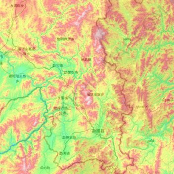
Name: 勐腊县 topographic map, elevation, terrain.
Location: 勐腊县, 西双版纳傣族自治州, Yunnan, 666100, China (21.14314 101.09257 22.40733 101.84467)
Average elevation: 984 m
Minimum elevation: 459 m
Maximum elevation: 1,962 m
Other topographic maps
Click on a map to view its topography, its elevation and its terrain.