Geolocate

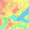
Agate topographic map

Click on the map to display elevation.

About this map

Name: Agate topographic map, elevation, terrain.

Location: Agate, Mason County, Washington, United States (47.19343 -123.03237 47.23343 -122.99237)

Average elevation: 32 m

Minimum elevation: -4 m

Maximum elevation: 81 m

Other topographic maps

Click on a map to view its topography, its elevation and its terrain.
Shelton

United States > Washington > Mason County

Average elevation: 54 m

Allyn

United States > Washington > Mason County > Allyn

Average elevation: 47 m

Belfair

United States > Washington > Mason County

Average elevation: 65 m

Oakland Bay

United States > Washington > Mason County > Shelton

Average elevation: 36 m

Price Lake

United States > Washington > Mason County

Average elevation: 326 m

Grapeview

United States > Washington > Mason County

Average elevation: 17 m

Shelton

United States > Washington > Mason County

Average elevation: 54 m

Lake Cushman

United States > Washington > Mason County

Average elevation: 410 m

Allyn

United States > Washington > Mason County > Allyn

Average elevation: 47 m

Belfair

United States > Washington > Mason County

Average elevation: 65 m

Gear up for your next adventure:

🧼Biodegradable Soaps - Eco‑friendly soap for backpacking
🧯Portable Extinguishers - Safety tools for campfires
🧉Camping Coffee Gear - Enjoy coffee outdoors
🎧Wireless Earbuds - Music on the move
🛌Cold Weather Sleeping Bags - Warm sleeping bags for colder hikes

As an Amazon Associate, this site earns from qualifying purchases at no extra cost to you.