Geolocate

Shelton topographic map

Click on the map to display elevation.

About this map
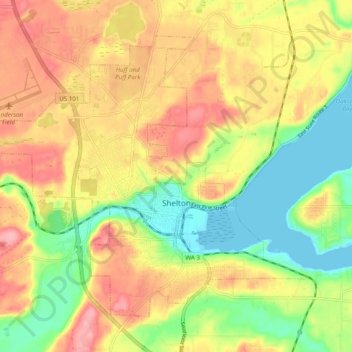
Name: Shelton topographic map, elevation, terrain.

Location: Shelton, Mason County, Washington, United States (47.19362 -123.16113 47.24668 -123.06343)

Average elevation: 54 m

Minimum elevation: -1 m

Maximum elevation: 106 m

Gear up for your next adventure:

🧦Merino Wool Socks - Moisture-wicking and blister-preventing trail socks
🧗Climbing Gear - Essential equipment for climbing routes
🧭Sighting Compasses - Professional grade mirror compass for precise orientation
🥾Waterproof Hiking Boots - Best waterproof boots for wet Irish weather
🐦Irish Bird Guides - Spot coastal and mountain birds during your hike

As an Amazon Associate, this site earns from qualifying purchases at no extra cost to you.