Geolocate

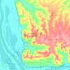
Lockhaven topographic map

Click on the map to display elevation.

About this map

Name: Lockhaven topographic map, elevation, terrain.

Location: Lockhaven, Jersey County, Illinois, 63302, United States (38.92064 -90.30815 38.96064 -90.26815)

Average elevation: 142 m

Minimum elevation: 126 m

Maximum elevation: 208 m

Other topographic maps

Click on a map to view its topography, its elevation and its terrain.

Jerseyville

United States > Illinois > Jersey County

Average elevation: 188 m

Grafton

United States > Illinois > Jersey County

Average elevation: 186 m

Jerseyville

United States > Illinois > Jersey County

Average elevation: 188 m

Grafton

United States > Illinois > Jersey County

Average elevation: 186 m

Elsah

United States > Illinois > Jersey County

Average elevation: 160 m

Grafton

United States > Illinois > Jersey County

Average elevation: 186 m

Gear up for your next adventure:

🌦️Weatherproof Outdoor Gear - Protection from unpredictable weather
🚴Mountain Bikes - Bikes for off‑road trails and terrain
🧦Hiking Socks - Comfortable socks to prevent blisters
🏕️Camping Chairs - Comfortable outdoor chairs for campsites
🍴Camp Kitchen Kits - Lightweight nesting pots and pans for backpacking

As an Amazon Associate, this site earns from qualifying purchases at no extra cost to you.