Geolocate

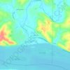
Elsah topographic map

Click on the map to display elevation.

About this map

Name: Elsah topographic map, elevation, terrain.

Location: Elsah, Jersey County, Illinois, United States (38.94256 -90.36742 38.96300 -90.34276)

Average elevation: 160 m

Minimum elevation: 126 m

Maximum elevation: 210 m

Other topographic maps

Click on a map to view its topography, its elevation and its terrain.
Lockhaven

United States > Illinois > Jersey County

Average elevation: 142 m

Dow

United States > Illinois > Jersey County

Average elevation: 197 m

Gear up for your next adventure:

🔌Travel Adapters - Essential for visitors to charge gear in Ireland
🔥Compact Camping Stoves - Fast-boil stoves for trail-side meals and coffee
🖼️Vintage Irish Map Prints - Decorative wall art for map lovers and geographers
📻Emergency Crank Radios - Stay informed in remote areas without power
🔋Rechargeable Batteries - Eco-friendly power for headlamps and GPS units

As an Amazon Associate, this site earns from qualifying purchases at no extra cost to you.