Geolocate

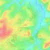
Crevant topographic map

Click on the map to display elevation.

About this map

Name: Crevant topographic map, elevation, terrain.

Location: Crevant, La Châtre, Indre, Centre-Val de Loire, Metropolitan France, 36140, France (46.43185 1.89774 46.51204 1.98505)

Average elevation: 369 m

Minimum elevation: 241 m

Maximum elevation: 471 m

Other topographic maps

Click on a map to view its topography, its elevation and its terrain.

Le Fragne

France > Centre-Val de Loire > Indre > Sarzay

Average elevation: 224 m

Fein

France > Centre-Val de Loire > Indre > Nohant-Vic

Average elevation: 198 m

Larage

France > Centre-Val de Loire > Indre > Migné > Chézal Fragné

Average elevation: 119 m

Grandchamp

France > Centre-Val de Loire > Indre > Pérassay

Average elevation: 334 m

Nuissance

France > Centre-Val de Loire > Indre > Levroux

Average elevation: 161 m

Nuissance

France > Centre-Val de Loire > Indre > Levroux

Average elevation: 161 m

L'Amoureux

France > Centre-Val de Loire > Indre > Champillet

Average elevation: 276 m

Les Arènes

France > Centre-Val de Loire > Indre > Levroux

Average elevation: 151 m

Avail

France > Centre-Val de Loire > Indre > Issoudun

Average elevation: 153 m

Éguzon

France > Centre-Val de Loire > Indre > Éguzon-Chantôme

Average elevation: 255 m

Les Marigouts

France > Centre-Val de Loire > Indre > Clion

Average elevation: 137 m

Charneuil

France > Centre-Val de Loire > Indre > Mauvières

Average elevation: 115 m

Gear up for your next adventure:

📟Handheld Altimeters - Track elevation changes and weather patterns accurately
🔪Multi‑Tools & Knives - Versatile tools for outdoor tasks
📍Handheld GPS Devices - Accurate GPS units for mapping and navigation
🛸Lightweight Camera Drones - Capture stunning aerial topographic views of the landscape
💡Hiking Headlamps - Hands‑free lights for night hikes

As an Amazon Associate, this site earns from qualifying purchases at no extra cost to you.