
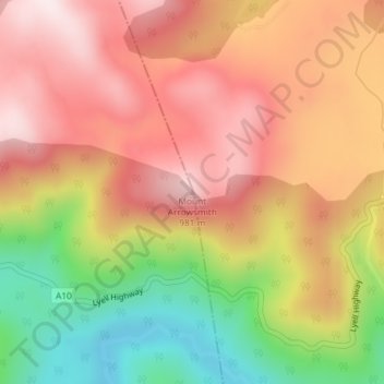
Mount Arrowsmith topographic map
Interactive map
Click on the map to display elevation.
About this map
Name: Mount Arrowsmith topographic map, elevation, terrain.
Location: Mount Arrowsmith, Tasmania, Australia (-42.21053 146.07518 -42.21043 146.07528)
Average elevation: 761 m
Minimum elevation: 459 m
Maximum elevation: 982 m
Other topographic maps
Click on a map to view its topography, its elevation and its terrain.
St Pauls River
St Pauls River, Avoca, Northern Midlands, Tasmania, Australia
Average elevation: 327 m
Macquarie Island
Australia > Tasmania > Macquarie Island Station
Macquarie Island, Macquarie Island Station, Huon Valley, Tasmania, Australia
Average elevation: 20 m
Mount Nelson
Mount Nelson, Hobart, City of Hobart, Tasmania, Australia
Average elevation: 198 m
Western Junction
Australia > Tasmania > Western Junction
Western Junction, Tasmania, 7212, Australia
Average elevation: 164 m