
Scottsdale topographic map
Interactive map
Click on the map to display elevation.
About this map
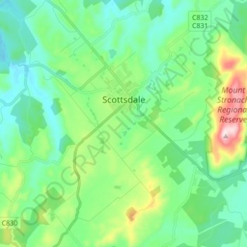
Name: Scottsdale topographic map, elevation, terrain.
Location: Scottsdale, Dorset, Tasmania, Australia (-41.21605 147.47014 -41.12289 147.57347)
Average elevation: 179 m
Minimum elevation: 75 m
Maximum elevation: 495 m
Other topographic maps
Click on a map to view its topography, its elevation and its terrain.