Geolocate

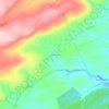
Butler Township topographic map

Click on the map to display elevation.

About this map

Name: Butler Township topographic map, elevation, terrain.

Location: Butler Township, Schuylkill County, Pennsylvania, United States (40.72270 -76.46900 40.81332 -76.23718)

Average elevation: 392 m

Minimum elevation: 204 m

Maximum elevation: 559 m

Other topographic maps

Click on a map to view its topography, its elevation and its terrain.
Gear up for your next adventure:

🛶Kayaking & Water Sports Gear - Equip for water adventures
⛺Ultralight Hiking Tents - Compact shelters for multi-day wild camping in Ireland
🧺Collapsible Camp Bowls - Save space in your expedition kit
🛰️Handheld GPS Units - Professional satellite navigation for Irish highlands
🪓Camping Axes & Hatchets - Wood cutting tools for campsite prep

As an Amazon Associate, this site earns from qualifying purchases at no extra cost to you.