Geolocate

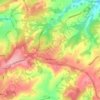
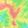
Cranbrook topographic map

Click on the map to display elevation.

About this map
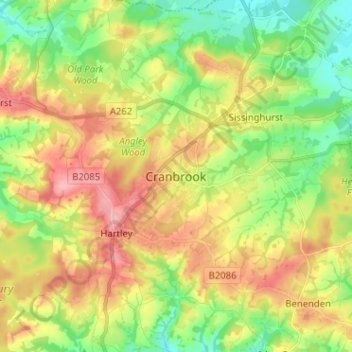
Name: Cranbrook topographic map, elevation, terrain.

Location: Cranbrook, Tunbridge Wells, Kent, England, TN17 3ES, United Kingdom (51.05655 0.49211 51.13655 0.57211)

Average elevation: 76 m

Minimum elevation: 26 m

Maximum elevation: 137 m

Other topographic maps

Click on a map to view its topography, its elevation and its terrain.

Frittenden

United Kingdom > England > Kent > Tunbridge Wells

Average elevation: 34 m

Hawkhurst

United Kingdom > England > Kent > Tunbridge Wells

Average elevation: 67 m

Paddock Wood

United Kingdom > England > Kent > Tunbridge Wells

Average elevation: 33 m

Goudhurst

United Kingdom > England > Kent > Tunbridge Wells > Goudhurst

Average elevation: 76 m

Benenden

United Kingdom > England > Kent > Tunbridge Wells

Average elevation: 61 m

Pembury

United Kingdom > England > Kent > Tunbridge Wells

Average elevation: 99 m

Bidborough

United Kingdom > England > Kent > Tunbridge Wells

Average elevation: 71 m

Horsmonden

United Kingdom > England > Kent > Tunbridge Wells > Horsmonden

Average elevation: 51 m

Speldhurst

United Kingdom > England > Kent > Tunbridge Wells

Average elevation: 89 m

Rusthall

United Kingdom > England > Kent > Tunbridge Wells > Rusthall

Average elevation: 100 m

Capel

United Kingdom > England > Kent > Tunbridge Wells

Average elevation: 47 m

Hurst Wood

United Kingdom > England > Kent > Tunbridge Wells > Rusthall

Average elevation: 101 m

Hawkhurst

United Kingdom > England > Kent > Tunbridge Wells

Average elevation: 67 m

Benenden

United Kingdom > England > Kent > Tunbridge Wells

Average elevation: 61 m

Goudhurst

United Kingdom > England > Kent > Tunbridge Wells

Average elevation: 76 m

Paddock Wood

United Kingdom > England > Kent > Tunbridge Wells > Whetsted

Average elevation: 33 m

Capel

United Kingdom > England > Kent > Tunbridge Wells

Average elevation: 47 m

Gear up for your next adventure:

🏃Men's Trail Runners - Grip and speed for rugged Irish mountain running
🧢Waterproof Caps - Keep rain off your face and glasses while hiking
📷Compact Binoculars - High-definition optics for scouting terrain and wildlife
🧭Sighting Compasses - Professional grade mirror compass for precise orientation
📚Irish Walking Guides - The best mapped trails in Wicklow, Kerry, and Connemara

As an Amazon Associate, this site earns from qualifying purchases at no extra cost to you.