Geolocate

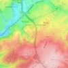
Ensival topographic maps

Click on a map to view its topography, its elevation and its terrain.

Chant des Oiseaux

Belgium > Liège > Verviers > Verviers > Ensival

Average elevation: 259 m

Gear up for your next adventure:

👣Orthopedic Boot Insoles - Extra comfort for long distance walking
🧥Waterproof Hiking Jackets - Rain jackets for unpredictable weather
🍴Camp Kitchen Kits - Lightweight nesting pots and pans for backpacking
☕Vacuum Insulated Flasks - Keep tea or coffee hot for 12 hours on the summit
🖊️All-Weather Pens - Pressurized ink cartridges that write upside down and in wet

As an Amazon Associate, this site earns from qualifying purchases at no extra cost to you.