Geolocate

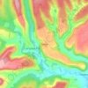
Broxa topographic maps

Click on a map to view its topography, its elevation and its terrain.

Broxa

United Kingdom > England > North Yorkshire > Scarborough > Broxa

Average elevation: 126 m

Gear up for your next adventure:

🚲Cycling GPS Computers - Topographic mapping for Irish road and mountain biking
🔨Multi-tool Devices - Versatile tools for gear repairs in the field
📱Rugged Smartphones - Waterproof phones with long battery for offline mapping
🦯Lightweight Trekking Poles - Reduce knee strain on steep Wicklow or Kerry slopes
🪶Down Jackets - Warm jackets for cold outdoor trips

As an Amazon Associate, this site earns from qualifying purchases at no extra cost to you.