Geolocate

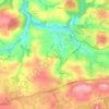
Lanivet topographic maps

Click on a map to view its topography, its elevation and its terrain.

Lanivet

United Kingdom > England > Cornwall > Lanivet

Average elevation: 101 m

Gear up for your next adventure:

📖Outdoor Guide Books - Expert guides for Irish nature
🪑Compact Camp Chairs - Comfortable seating after a long day of mapping
💳Travel Cards for Ireland - Convenient payment abroad
🧤Touchscreen Glove Liners - Use your mapping app without freezing your hands
🗺️Topographic Maps - Detailed maps for hiking, cycling and planning routes

As an Amazon Associate, this site earns from qualifying purchases at no extra cost to you.