Geolocate

Pickens County topographic maps

Click on a map to view its topography, its elevation and its terrain.

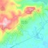
Hillwood

United States > South Carolina > Pickens County

Average elevation: 318 m

Norris

United States > South Carolina > Pickens County

Average elevation: 276 m

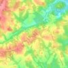
Six Mile

United States > South Carolina > Pickens County

Average elevation: 306 m

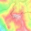
Sassafras Mountain

United States > South Carolina > Pickens County

The Pisgah Quadrangle topographical map, revised 1904–1905, shows the long abandoned Sassafras Gap Road to be the preferred route through to Rosman, N.C. and Brevard, N.C. at the end of the 19th century and that the existing Highway 178 was then a secondary road. This abandoned road is a short distance from…

Average elevation: 895 m
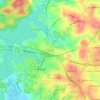
Pickens

United States > South Carolina > Pickens County

Average elevation: 315 m

Clemson

United States > South Carolina > Pickens County

Average elevation: 224 m

Calhoun

United States > South Carolina > Pickens County > Clemson

Average elevation: 227 m

Easley

United States > South Carolina > Pickens County

Average elevation: 301 m

Sunset

United States > South Carolina > Pickens County

Average elevation: 382 m

Central

United States > South Carolina > Pickens County

Average elevation: 258 m

Liberty

United States > South Carolina > Pickens County

Average elevation: 287 m

About this place

 •  •

Gear up for your next adventure:

📦Outdoor Storage Bags - Keep gear organized and dry
👣Waterproof Leg Gaiters - Keep bog water and debris out of your boots
🛶Inflatable Touring Kayaks - Explore Irish loughs and coastal topography
🎒Hiking Backpacks - Durable backpacks for day hikes and multi‑day treks
🛰️Handheld GPS Units - Professional satellite navigation for Irish highlands

As an Amazon Associate, this site earns from qualifying purchases at no extra cost to you.