Geolocate

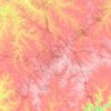
Lexington topographic maps

Click on a map to view its topography, its elevation and its terrain.

Lexington

United States > Kentucky > Lexington

Average elevation: 285 m

Gear up for your next adventure:

🔭Laser Distance Meters - Professional precision measuring for site surveys
💨Windbreakers - Protection from strong winds
🚰Hydration Packs - Hands‑free water storage for hikers
🚲Cycling GPS Computers - Topographic mapping for Irish road and mountain biking
🦯Lightweight Trekking Poles - Reduce knee strain on steep Wicklow or Kerry slopes

As an Amazon Associate, this site earns from qualifying purchases at no extra cost to you.