Geolocate

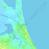
Rosslare topographic maps

Click on a map to view its topography, its elevation and its terrain.

Rosslare

Ireland > Rosslare

Average elevation: 2 m

Gear up for your next adventure:

🔋Lithium Batteries - Best performance for digital devices in cold weather
📱Rugged Smartphones - Waterproof phones with long battery for offline mapping
🥘Camping Cookware Sets - Cookware sets for backpacking meals
🧿Weather Radios - Track weather in remote places
📈Fitness Trackers - Monitor activity and hike metrics

As an Amazon Associate, this site earns from qualifying purchases at no extra cost to you.