

Thailand topographic maps
Click on a map to view its topography, its elevation and its terrain.

Thailand
Thailand comprises several distinct geographic regions, partly corresponding to the provincial groups. The north of the country is the mountainous area of the Thai highlands, with the highest point being Doi Inthanon in the Thanon Thong Chai Range at 2,565 metres (8,415 ft) elevation. The northeast, Isan,…
Average elevation: 156 m
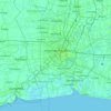
Bangkok
Bangkok is in the Chao Phraya River delta in Thailand's central plain. The river meanders through the city in a southerly direction, emptying into the Gulf of Thailand approximately 25 kilometres (16 mi) south of city centre. The area is flat and low-lying, with an average elevation of 1.5 metres (4 ft 11 in)…
Average elevation: 3 m

Bangkok
Bangkok is situated in the Chao Phraya River delta in Thailand's central plain. The river meanders through the city in a southerly direction, emptying into the Gulf of Thailand approximately 25 kilometres (16 mi) south of city centre. The area is flat and low-lying, with an average elevation of 1.5 metres (4…
Average elevation: 4 m

Khon Kaen
Khon Kaen is on the Khorat Plateau, elevation 187 m, and is the center of the mid-northeastern provincial group of Thailand, according to the Thai government. Its coordinates are 16°26′N 102°50′E / 16.433°N 102.833°E / 16.433; 102.833. The city municipality has a population of 114,459, while…
Average elevation: 165 m


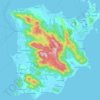


Muban Chom Phu Niwet
Thailand > Mueang Nakhon Pathom District > Nakhon Pathom City Municipality
Average elevation: 7 m


Mu 9
Thailand > Khlong Ha Subdistrict Administrative Organization > Khlong Ha Subdistrict
Average elevation: 4 m

Ban Bang Luang
Thailand > Suan Phrik Thai Subdistrict Administrative Organization > Suan Phrik Thai Subdistrict
Average elevation: 4 m


Ban Khlong Bang Kamlang
Thailand > Mueang Nonthaburi District > Sai Ma Subdistrict
Average elevation: 5 m


Khao Yai National Park
The park is the third largest in Thailand. It covers an area of 1,353,472 rai ~ 2,166 km2 (836 sq mi), including tropical seasonal forests and grasslands. Elevations mostly from 400–1,000 m (1,300–3,300 ft). There are 3,000 species of plants, 320 species of birds such as red junglefowl and coral-billed…
Average elevation: 320 m


Mu 1
Thailand > Khlong Hok Subdistrict Administrative Organization > Khlong Hok Subdistrict
Average elevation: 4 m


Khlong Nueng
Thailand > Sai Noi District > Sai Yai Subdistrict > Ban Khlong Song
Average elevation: 3 m


Ban Wat Sak
Thailand > Bang Khanun Subdistrict Administrative Organization > Bang Khanun Subdistrict
Average elevation: 5 m

Ban Bang Bo
Thailand > Bang Bo Subdistrict Administrative Organization > Bang Bo Subdistrict
Average elevation: 3 m

Khlong Chek
Thailand > Laem Fa Pha Subdistrict Administrative Organization > Laem Fa Pha Subdistrict > Ban Khun Samut Thai
Average elevation: 2 m


Bang Kruai Subdistrict
Thailand > Bang Kruai District > Bang Kruai Town Municipality
Average elevation: 5 m

Bang Sao Thong Subdistrict
Thailand > Bang Sao Thong Subdistrict Administrative Organization
Average elevation: 3 m


Khlong Phraya Suren
Thailand > Lam Luk Ka District > Lat Sawai Town Municipality
Average elevation: 4 m


Ban Bang Prong
Thailand > Bang Prong Subdistrict Administrative Organization > Bang Prong Subdistrict
Average elevation: 4 m