Geolocate

Baldwin County topographic maps

Click on a map to view its topography, its elevation and its terrain.
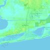
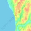
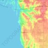
Gulf Shores

United States > Alabama > Baldwin County

Average elevation: 4 m

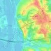
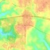
Seminole

United States > Alabama > Baldwin County

Average elevation: 13 m

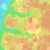
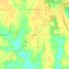
Montrose

United States > Alabama > Baldwin County > Fairhope

Average elevation: 17 m

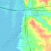
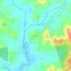
Latham

United States > Alabama > Baldwin County

Average elevation: 31 m

Park City

United States > Alabama > Baldwin County > Daphne

Average elevation: 17 m

Stockton

United States > Alabama > Baldwin County

Average elevation: 20 m

Wolf Creek

United States > Alabama > Baldwin County > Foley

Average elevation: 11 m

Perdido

United States > Alabama > Baldwin County > Perdido

Average elevation: 66 m

Stapleton

United States > Alabama > Baldwin County > Stapleton

Average elevation: 52 m

Stockton

United States > Alabama > Baldwin County

Average elevation: 17 m

Perdido River

United States > Alabama > Baldwin County

Average elevation: 43 m

Fairhope

United States > Alabama > Baldwin County

According to the U.S. Census Bureau, the city has a total area of 12.0 square miles (31.1 km2), of which 0.019 square mile (0.05 km2), or 0.16%, is water. Its elevation ranges from sea level at the bay to 122 feet (37 m) in the city center.

Average elevation: 17 m

Elberta

United States > Alabama > Baldwin County

Average elevation: 19 m

Lillian

United States > Alabama > Baldwin County > Lillian

Average elevation: 9 m

Spanish Fort

United States > Alabama > Baldwin County

Average elevation: 21 m

Bay Minette

United States > Alabama > Baldwin County

Average elevation: 52 m

Bay Minette

United States > Alabama > Baldwin County

Average elevation: 72 m

Foley

United States > Alabama > Baldwin County

Average elevation: 20 m

Robertsdale

United States > Alabama > Baldwin County

Average elevation: 41 m

Bon Secour

United States > Alabama > Baldwin County > Bon Secour

Bon Secour lies on the Bon Secour River. Elevation is 10 feet (3.0 m) above sea level. The estuarial river system empties into Bon Secour Bay at Mobile Bay.

Average elevation: 6 m

Summerdale

United States > Alabama > Baldwin County

The Navy Outlying Landing Field (NOLF) Summerdale airport is on the east side of Summerdale (at latitude, longitude: 30.507695, –87.645541). The Airport Code is NFD, in region: ASO - Southern, with boundary ARTCC: ZJX - Jacksonville, and Tie-in FSS: ANB - Anniston. The airport runway length/width is 2850 x…

Average elevation: 32 m

Gulf Shores

United States > Alabama > Baldwin County

Average elevation: 5 m

Ono Island

United States > Alabama > Baldwin County

Ono Island was along the boundary of the treaties between France and Spain. In 1813, after protests and attempts at rebellion, President James Monroe seized Spanish lands west of the Perdido River and declared them a part of the Louisiana Purchase of 1803. This set the east end of the Island, Perdido Key, at…

Average elevation: 9 m

Point Clear

United States > Alabama > Baldwin County > Fairhope

Average elevation: 22 m

Daphne

United States > Alabama > Baldwin County

The topography of Daphne is quite consistent from a gently sloping sea level on the west to low rolling hills further east. Generally, the entire city lies no more than 150 feet above sea level. The land along the Daphne bay coast, like other land throughout the county, is rich with sandy-loam type soils.

Average elevation: 25 m
Pine Grove

United States > Alabama > Baldwin County

Average elevation: 65 m

Orange Beach

United States > Alabama > Baldwin County

Average elevation: 4 m

Malbis

United States > Alabama > Baldwin County > Daphne

Average elevation: 51 m

Rosinton

United States > Alabama > Baldwin County

Average elevation: 47 m

Bromley

United States > Alabama > Baldwin County

Average elevation: 17 m

Loxley

United States > Alabama > Baldwin County

Average elevation: 46 m

About this place

 •  •  •  •  •  •  •  •  •  •

Gear up for your next adventure:

🧴Long-Lasting Sunscreen - Protect against UV rays during long days on the ridges
🩰Hiking Binoculars - See long distances on trails
🧿Outdoor Gadgets - Innovative tools for outdoor enthusiasts
☕Vacuum Insulated Flasks - Keep tea or coffee hot for 12 hours on the summit
📱Phone Holders for Biking - Secure phone mounts for touring cyclists

As an Amazon Associate, this site earns from qualifying purchases at no extra cost to you.