
Napo County topographic map
Interactive map
Click on the map to display elevation.
About this map
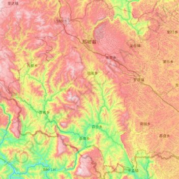
Name: Napo County topographic map, elevation, terrain.
Location: Napo County, Baise City, Guangxi, China (22.91677 105.52397 23.53198 106.10598)
Average elevation: 899 m
Minimum elevation: 154 m
Maximum elevation: 1,658 m
Other topographic maps
Click on a map to view its topography, its elevation and its terrain.
Guzai
China > Guangxi > Du'an Yao Autonomous County
Guzai, Du'an Yao Autonomous County, Hechi, Guangxi, China
Average elevation: 152 m
Kayang
China > Guangxi > Baise City > Kayang
Kayang, Baise City, Longlin Various Nationalities Autonomous County, Guangxi, China
Average elevation: 1,476 m