
Santon topographic map
Interactive map
Click on the map to display elevation.
About this map
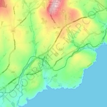
Name: Santon topographic map, elevation, terrain.
Location: Santon, Middle, Isle of Man (54.09095 -4.60572 54.15096 -4.52877)
Average elevation: 73 m
Minimum elevation: -1 m
Maximum elevation: 221 m
Other topographic maps
Click on a map to view its topography, its elevation and its terrain.