
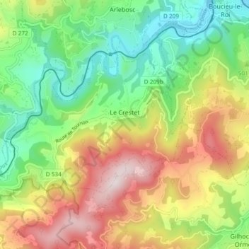
Le Crestet topographic map
Interactive map
Click on the map to display elevation.
About this map
Name: Le Crestet topographic map, elevation, terrain.
Average elevation: 507 m
Minimum elevation: 263 m
Maximum elevation: 851 m
Other topographic maps
Click on a map to view its topography, its elevation and its terrain.
Gluiras
France > Auvergne-Rhône-Alpes > Ardèche
Gluiras, Privas, Ardèche, Auvergne-Rhône-Alpes, Metropolitan France, 07190, France
Average elevation: 599 m
Vallon-Pont-d'Arc
France > Auvergne-Rhône-Alpes > Ardèche > Vallon-Pont-d'Arc
Vallon-Pont-d'Arc, Largentière, Ardèche, Auvergne-Rhône-Alpes, Metropolitan France, 07150, France
Average elevation: 191 m
Berrias
France > Auvergne-Rhône-Alpes > Ardèche > Berrias-et-Casteljau
Berrias, Berrias-et-Casteljau, Largentière, Ardèche, Auvergne-Rhône-Alpes, Metropolitan France, 07460, France
Average elevation: 174 m