
Dalkey Commons topographic map
Interactive map
Click on the map to display elevation.
About this map
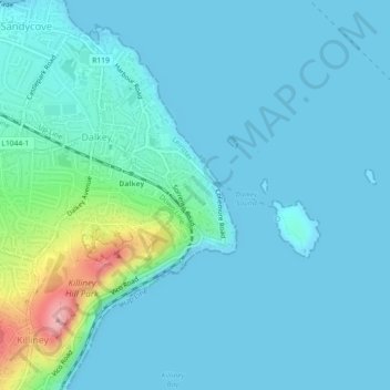
Name: Dalkey Commons topographic map, elevation, terrain.
Average elevation: 19 m
Minimum elevation: 0 m
Maximum elevation: 148 m
Other topographic maps
Click on a map to view its topography, its elevation and its terrain.
Dalkey-Bullock ED
Dalkey-Bullock ED, Dalkey, Dún Laoghaire-Rathdown, County Dublin, Leinster, SW17 7EG, Ireland
Average elevation: 22 m
Dalkey Island
Dalkey Island, Shankill-Rathsallagh ED, Dalkey, Dún Laoghaire-Rathdown, County Dublin, Leinster, Ireland
Average elevation: 6 m