
Glen Gardner topographic map
Interactive map
Click on the map to display elevation.
About this map
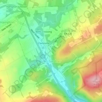
Name: Glen Gardner topographic map, elevation, terrain.
Location: Glen Gardner, Hunterdon County, New Jersey, United States (40.68703 -74.95247 40.71182 -74.92578)
Average elevation: 183 m
Minimum elevation: 108 m
Maximum elevation: 286 m