
Pulam Sumda topographic map
Click on the map to display elevation.
About this map
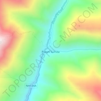
Name: Pulam Sumda topographic map, elevation, terrain.
Location: Pulam Sumda, Bhatwari, Uttarkashi District, Uttarakhand, India (31.30591 79.12956 31.30752 79.13161)
Average elevation: 4,570 m
Minimum elevation: 4,267 m
Maximum elevation: 5,039 m
Other topographic maps
Click on a map to view its topography, its elevation and its terrain.
Uttarkashi
India > Uttarakhand > Bhatwari
It is the district headquarters of Uttarkashi district. Uttarkashi is situated on the banks of river Bhagirathi at an altitude of 1158 m above sea level. Uttarkashi is generally known as a holy town close to Rishikesh. It is located in the state of Uttarakhand in India. Uttarkashi is home to a number of…
Average elevation: 1,619 m