
Thank you for supporting this site ❤️
Make a donation
Make a donation
Gear up for your next adventure:
As an Amazon Associate, this site earns from qualifying purchases at no extra cost to you.
Todalsøra topographic map
Click on the map to display elevation.
Thank you for supporting this site ❤️
Make a donation
Make a donation
Gear up for your next adventure:
As an Amazon Associate, this site earns from qualifying purchases at no extra cost to you.
About this map
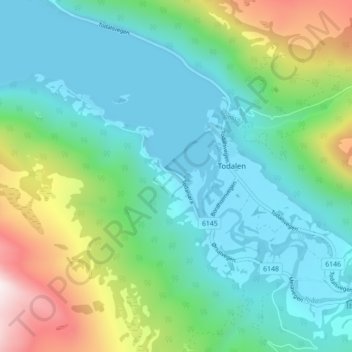
Name: Todalsøra topographic map, elevation, terrain.
Location: Todalsøra, Todalen, Surnadal, Møre og Romsdal, Norway (62.79840 8.67000 62.83840 8.71000)
Average elevation: 239 m
Minimum elevation: -1 m
Maximum elevation: 960 m
Thank you for supporting this site ❤️
Make a donation
Make a donation
Gear up for your next adventure:
As an Amazon Associate, this site earns from qualifying purchases at no extra cost to you.