
茨开镇 topographic map
Interactive map
Click on the map to display elevation.
About this map
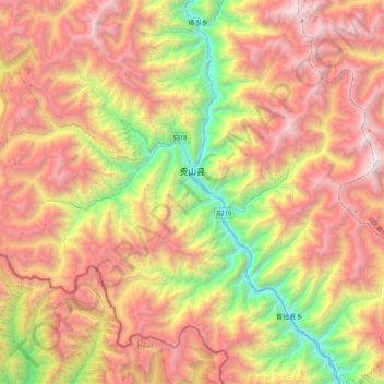
Name: 茨开镇 topographic map, elevation, terrain.
Location: 茨开镇, 贡山独龙族怒族自治县, 怒江傈僳族自治州, 云南省, 中国 (27.56840 98.44093 27.87810 98.87260)
Average elevation: 3,061 m
Minimum elevation: 1,370 m
Maximum elevation: 4,766 m
Other topographic maps
Click on a map to view its topography, its elevation and its terrain.