
中山植物园 topographic map
Interactive map
Click on the map to display elevation.
About this map
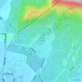
Name: 中山植物园 topographic map, elevation, terrain.
Location: 中山植物园, 西马腰到停车场, 孝陵卫街道, 玄武区, 南京市, 江苏省, 210012, 中国 (32.05209 118.82374 32.06384 118.83368)
Average elevation: 75 m
Minimum elevation: 10 m
Maximum elevation: 388 m