
Fusagasugá topographic map
Interactive map
Click on the map to display elevation.
About this map
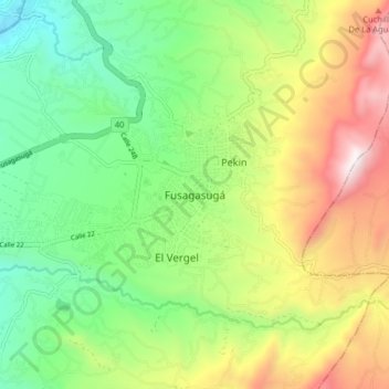
Name: Fusagasugá topographic map, elevation, terrain.
Location: Fusagasugá, Región Andina, 252212, Colombia (4.29692 -74.40449 4.37692 -74.32449)
Average elevation: 1,790 m
Minimum elevation: 1,272 m
Maximum elevation: 2,619 m