

Dompierre-sur-Mer topographic map
Click on the map to display elevation.
About this map

Name: Dompierre-sur-Mer topographic map, elevation, terrain.
Average elevation: 21 m
Minimum elevation: 3 m
Maximum elevation: 37 m
Other topographic maps
Click on a map to view its topography, its elevation and its terrain.
La Menounière
France > Nouvelle-Aquitaine > Charente-Maritime > Saint-Pierre-d'Oléron
Average elevation: 3 m

Chenac
France > Nouvelle-Aquitaine > Charente-Maritime > Chenac-Saint-Seurin-d'Uzet
Average elevation: 25 m

Le Lindron
France > Nouvelle-Aquitaine > Charente-Maritime > Marennes-Hiers-Brouage
Average elevation: 5 m



Chez Richard
France > Nouvelle-Aquitaine > Charente-Maritime > Montlieu-la-Garde
Average elevation: 108 m

Les Moulins
France > Nouvelle-Aquitaine > Charente-Maritime > Montlieu-la-Garde
Average elevation: 110 m


Les Blanches
France > Nouvelle-Aquitaine > Charente-Maritime > Le Bois-Plage-en-Ré
Average elevation: 4 m

Les Pibles
France > Nouvelle-Aquitaine > Charente-Maritime > Saint-Pierre-d'Oléron
Average elevation: 3 m

Le Caillaud
France > Nouvelle-Aquitaine > Charente-Maritime > Talmont-sur-Gironde
Average elevation: 3 m


La Richarde
France > Nouvelle-Aquitaine > Charente-Maritime > Mortagne-sur-Gironde > La Richarde
Average elevation: 30 m


Vergeroux
France > Nouvelle-Aquitaine > Charente-Maritime > Vergeroux > Vergeroux
Average elevation: 5 m

Saint-Jean-d'Angély
France > Nouvelle-Aquitaine > Charente-Maritime > Saint-Jean-d'Angély > Saint-Jean-d'Angély
Average elevation: 38 m

Fontenet
France > Nouvelle-Aquitaine > Charente-Maritime > Fontenet > Fontenet
Average elevation: 38 m

Château du Douhet
France > Nouvelle-Aquitaine > Charente-Maritime > Le Douhet > Les Vinets
Average elevation: 57 m
La Palud
France > Nouvelle-Aquitaine > Charente-Maritime > Saint-Palais-sur-Mer
Average elevation: 16 m
La Gravelle
France > Nouvelle-Aquitaine > Charente-Maritime > Mortagne-sur-Gironde
Average elevation: 16 m
Moulin Rompu
France > Nouvelle-Aquitaine > Charente-Maritime > Mortagne-sur-Gironde
Average elevation: 28 m

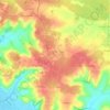
La Ramigère Est
France > Nouvelle-Aquitaine > Charente-Maritime > Mortagne-sur-Gironde
Average elevation: 41 m


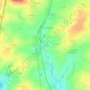
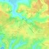
Beaulieu
France > Nouvelle-Aquitaine > Charente-Maritime > Saint-Palais-sur-Mer
Average elevation: 20 m


La Martinière
France > Nouvelle-Aquitaine > Charente-Maritime > Saint-Georges-des-Coteaux
Average elevation: 53 m


Montvollant
France > Nouvelle-Aquitaine > Charente-Maritime > Bussac-sur-Charente
Average elevation: 27 m


Lede du Riveau
France > Nouvelle-Aquitaine > Charente-Maritime > Ronce-les-Bains
Average elevation: 5 m

Poursay
France > Nouvelle-Aquitaine > Charente-Maritime > Poursay-Garnaud
Plusieurs études ont été menées afin de caractériser les types climatiques auxquels est exposé le territoire national. Les zonages obtenus diffèrent selon les méthodes utilisées, la nature et le nombre des paramètres pris en compte, le maillage territorial des données et la période de référence.…
Average elevation: 37 m

Pointe des Gonthières
France > Nouvelle-Aquitaine > Charente-Maritime > Puilboreau
Average elevation: 18 m


Le Bourg
France > Nouvelle-Aquitaine > Charente-Maritime > Andilly-les-Marais > Andilly
Average elevation: 8 m


La Croix du Pouilloux
France > Nouvelle-Aquitaine > Charente-Maritime > Sainte-Lheurine
Average elevation: 60 m

Plage de Chef de Baie
France > Nouvelle-Aquitaine > Charente-Maritime > La Rochelle
Average elevation: 3 m


Le Berceau
France > Nouvelle-Aquitaine > Charente-Maritime > Meschers-sur-Gironde
Average elevation: 14 m

Le Puits Courant
France > Nouvelle-Aquitaine > Charente-Maritime > Allas-Bocage
Average elevation: 69 m
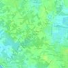
Saint-Gilles d'Oléron
France > Nouvelle-Aquitaine > Charente-Maritime > Saint-Pierre-d'Oléron
Average elevation: 7 m

La Pommeraie des Gaillards
France > Nouvelle-Aquitaine > Charente-Maritime > Port-d'Envaux
Average elevation: 26 m


Moulin de la Croix
France > Nouvelle-Aquitaine > Charente-Maritime > Saint-Pierre-d'Oléron
Average elevation: 6 m

Champservé le Haut
France > Nouvelle-Aquitaine > Charente-Maritime > Tonnay-Charente
Average elevation: 13 m
Champservé le Bas
France > Nouvelle-Aquitaine > Charente-Maritime > Tonnay-Charente
Average elevation: 11 m

Les Bagnes
France > Nouvelle-Aquitaine > Charente-Maritime > Saint-Pierre-d'Oléron
Average elevation: 5 m
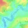
La Sauzaie
France > Nouvelle-Aquitaine > Charente-Maritime > Dampierre-sur-Boutonne
Average elevation: 54 m
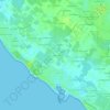


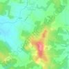

Les Biraudes
France > Nouvelle-Aquitaine > Charente-Maritime > Saint-Martin-de-Ré
Average elevation: 7 m
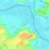


Le Puits d'Asnières
France > Nouvelle-Aquitaine > Charente-Maritime > Asnières-la-Giraud
Average elevation: 59 m

Le Breuil Malmaud
France > Nouvelle-Aquitaine > Charente-Maritime > Saint-Martin-de-Juillers
Average elevation: 65 m

Le Moulin de la Brande
France > Nouvelle-Aquitaine > Charente-Maritime > Aigrefeuille-d'Aunis
Average elevation: 21 m



La Fromagère
France > Nouvelle-Aquitaine > Charente-Maritime > Dompierre-sur-Mer
Average elevation: 21 m


Le Treuil Arnaudeau
France > Nouvelle-Aquitaine > Charente-Maritime > Saint-Médard-d'Aunis
Average elevation: 32 m



Le Maurin
France > Nouvelle-Aquitaine > Charente-Maritime > Saint-Martin-d'Ary
Average elevation: 78 m