
Thank you for supporting this site ❤️
Make a donation
Make a donation
Gear up for your next adventure:
As an Amazon Associate, this site earns from qualifying purchases at no extra cost to you.
Minden topographic map
Click on the map to display elevation.
Thank you for supporting this site ❤️
Make a donation
Make a donation
Gear up for your next adventure:
As an Amazon Associate, this site earns from qualifying purchases at no extra cost to you.
About this map
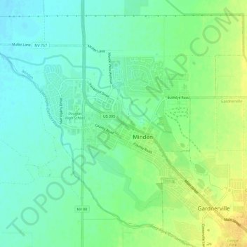
Name: Minden topographic map, elevation, terrain.
Location: Minden, Douglas County, Nevada, 89423, United States (38.93723 -119.79920 38.97591 -119.74260)
Average elevation: 1,440 m
Minimum elevation: 1,429 m
Maximum elevation: 1,456 m
Thank you for supporting this site ❤️
Make a donation
Make a donation
Gear up for your next adventure:
As an Amazon Associate, this site earns from qualifying purchases at no extra cost to you.