
Thank you for supporting this site ❤️
Make a donation
Make a donation
Gear up for your next adventure:
As an Amazon Associate, this site earns from qualifying purchases at no extra cost to you.
Lilydale topographic map
Click on the map to display elevation.
Thank you for supporting this site ❤️
Make a donation
Make a donation
Gear up for your next adventure:
As an Amazon Associate, this site earns from qualifying purchases at no extra cost to you.
About this map
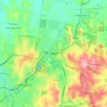
Name: Lilydale topographic map, elevation, terrain.
Location: Lilydale, Shire of Yarra Ranges, Victoria, 3140, Australia (-37.79766 145.31241 -37.71766 145.39241)
Average elevation: 133 m
Minimum elevation: 50 m
Maximum elevation: 267 m
Thank you for supporting this site ❤️
Make a donation
Make a donation
Gear up for your next adventure:
As an Amazon Associate, this site earns from qualifying purchases at no extra cost to you.