
水碾 topographic map
Interactive map
Click on the map to display elevation.
About this map
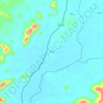
Name: 水碾 topographic map, elevation, terrain.
Location: 水碾, 龙岸镇, 罗城仫佬族自治县, 河池市, 广西壮族自治区, 中国 (24.98089 108.96103 25.02089 109.00103)
Average elevation: 139 m
Minimum elevation: 118 m
Maximum elevation: 289 m
Other topographic maps
Click on a map to view its topography, its elevation and its terrain.