
下蜀镇 topographic map
Interactive map
Click on the map to display elevation.
About this map
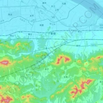
Name: 下蜀镇 topographic map, elevation, terrain.
Location: 下蜀镇, 句容市, 镇江市, 江苏省, 212400, 中国 (32.07219 119.12072 32.21811 119.27195)
Average elevation: 60 m
Minimum elevation: 0 m
Maximum elevation: 422 m
Other topographic maps
Click on a map to view its topography, its elevation and its terrain.