
Thank you for supporting this site ❤️
Make a donation
Make a donation
Gear up for your next adventure:
As an Amazon Associate, this site earns from qualifying purchases at no extra cost to you.
Anderwan topographic map
Click on the map to display elevation.
Thank you for supporting this site ❤️
Make a donation
Make a donation
Gear up for your next adventure:
As an Amazon Associate, this site earns from qualifying purchases at no extra cost to you.
About this map
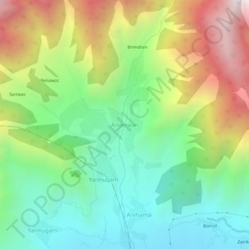
Name: Anderwan topographic map, elevation, terrain.
Location: Anderwan, Kangan, Ganderbal District, Jammu and Kashmir, India (34.29296 74.79449 34.33296 74.83449)
Average elevation: 2,348 m
Minimum elevation: 1,769 m
Maximum elevation: 3,320 m
Thank you for supporting this site ❤️
Make a donation
Make a donation
Gear up for your next adventure:
As an Amazon Associate, this site earns from qualifying purchases at no extra cost to you.