
Thank you for supporting this site ❤️
Make a donation
Make a donation
Gear up for your next adventure:
As an Amazon Associate, this site earns from qualifying purchases at no extra cost to you.
Olbernhau topographic map
Click on the map to display elevation.
Thank you for supporting this site ❤️
Make a donation
Make a donation
Gear up for your next adventure:
As an Amazon Associate, this site earns from qualifying purchases at no extra cost to you.
About this map
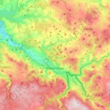
Name: Olbernhau topographic map, elevation, terrain.
Location: Olbernhau, Erzgebirgskreis, Saxony, 09526, Germany (50.59679 13.23731 50.75304 13.44796)
Average elevation: 612 m
Minimum elevation: 392 m
Maximum elevation: 842 m
Thank you for supporting this site ❤️
Make a donation
Make a donation
Gear up for your next adventure:
As an Amazon Associate, this site earns from qualifying purchases at no extra cost to you.